Optimisation of inner-city transport links
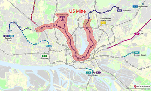
The new U5 underground line will close important gaps in Hamburg's underground rail network along a route of approximately 30 km. The aim of the construction project is to create convenient transfer options for passengers to other existing rapid transit lines to optimise the service offered by the network.
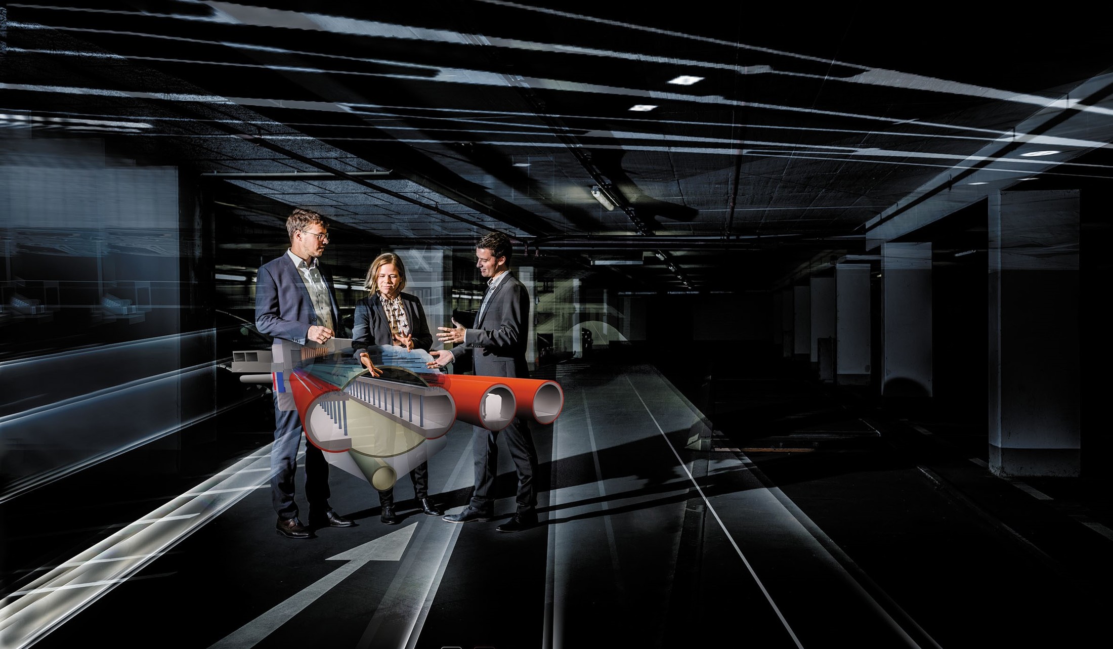
The general planning for the U5 Mitte (centre) comprises the preliminary design of transport plans, engineering and tunnel structures, the architecture and the technical facilities along a stretch of 13 to 17 km. Extensive special, expertise and consultancy services are provided with an interdisciplinary approach. The U5 Mitte engineering consortium was commissioned by Hamburger Hochbahn AG to design the entire inner-city route including 14 to 17 underground stations. Schüßler-Plan acts as lead engineering manager in the engineering consortium.
Read more
The route runs completely underground and passes under numerous buildings, infrastructure facilities and the Binnenalster lake. It lies entirely below the groundwater table. For the first time, BIM was used in the preliminary design phase to conduct extensive planning work. This includes the acquisition of all the required as-built data in a digital terrain model developed by Schüssler-Plan.
Fully Automatic Operation
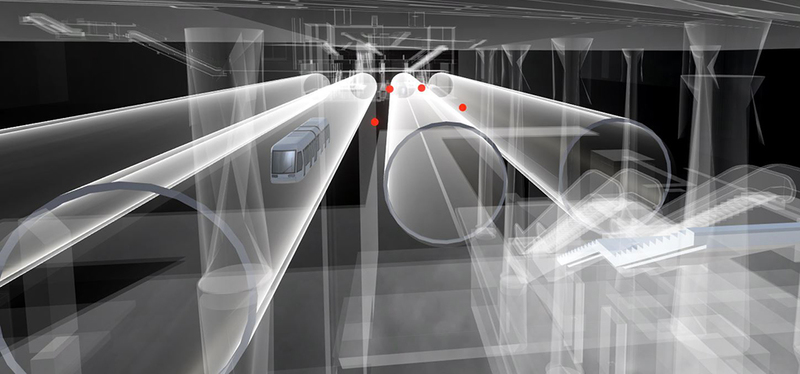
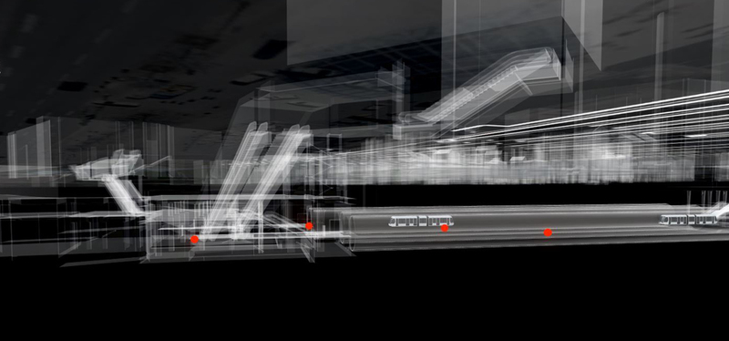
Another special feature of the underground rail project is that the line is to be operated by fully automated driverless trains. For this reason, the platforms must be shielded from the tracks by PSD (platform screen doors) for safety reasons. The U5 is to operate at a frequency of every 90 seconds. To implement such a high line frequency coupled with the required high availability despite operational disruptions, complex underground operating facilities besides the tracks are called for, including facilities for train reversing, sidings and track changing.
Open BIM General Design with Project-Specific Document Management System
In the preliminary design phase, BIM provided a number of different design services, including model-based design derivation, a 3D coordination model for a detailed representation of as-built structures and three models for the extension and expansion of the "Hauptbahnhof", "Hoheluftbrücke" and "Jarrestrasse" stations.
The comprehensive as-built model is therefore a special feature because it allows a large volume of information about existing pipelines and buildings to be integrated and evaluated semi-automatically along the entire length of the route. The following themes were addressed in the as-built model:
- Integration of official land registry (ALKIS, city models), existing pipelines and sluices.
- Geometric and semantic supplementation of the models with as-built information and survey data (foundation depths, balconies, street names and house numbers, cadastral numbers, building type, foundation type, etc.); comparison of the models with survey data.
- Definition of interfaces and transfer formats of the program systems.
- Links to documents of the as-built review (as-built plans, as-built structural analyses, etc.) with a view to a single source of truth solution.
- Functional evaluation of the models with standardised interfaces and forms (SPBIM) in the coordination software to achieve user-friendly operation.
- Data filing and storage to establish a linked data approach.
- Design derivation, construction phase simulation and cost planning.
Moreover, the as-built model is used together with the technical models of the stations in trades comprising architecture, technical building equipment, civil engineering and route planning to represent the use cases of design derivation, construction phase simulations and cost planning. A project-specific document management system based on SharePoint was developed and managed for the general planner's team as well as for the client. It acts as a single source of truth solution for the management of documents and files and is used by more than 100 people assigned to a total of seven user groups. The following functionalities were mapped:
- Integration of a project-specific metadata and folder-related filing structure with associated filter and search functions.
- Development of a metadata concept and a file naming convention for defined user groups to map access rights based on DIN EN ISO 19650.
- Web-based file access from PCs, laptops and mobile devices.
- Contact list, phone book and calendar for project organisation.